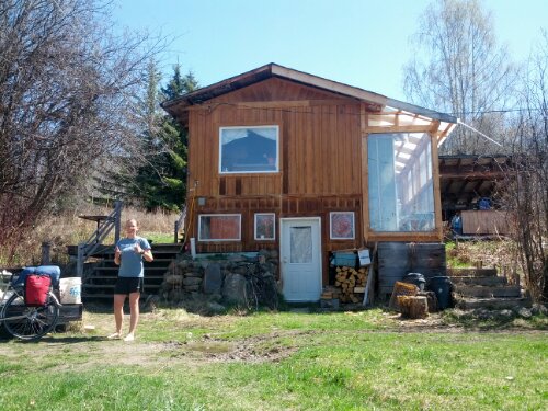
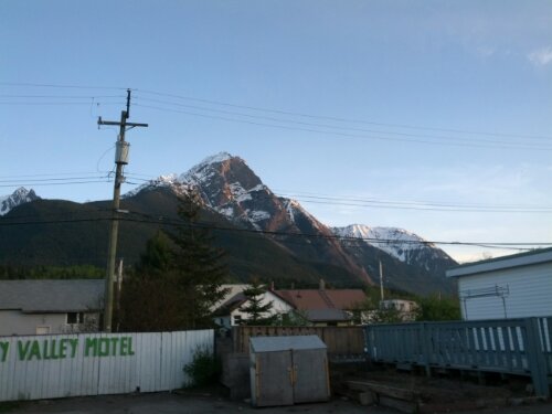
Days 35 – 39: Beaver Creek, YT – Glennallen, AK

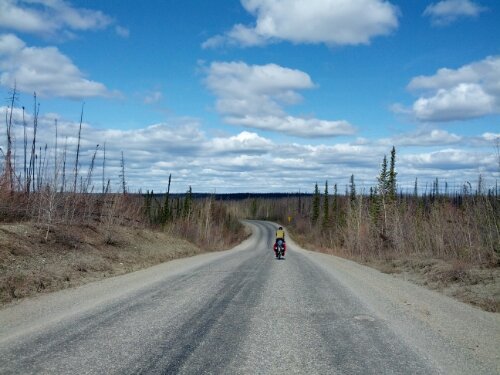
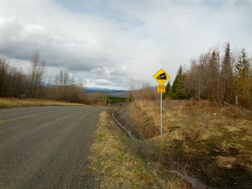
For hundreds of miles we have been warned by passing motorists of the twenty mile stretch of road between Beaver Creek and the Alaska border. It’s called “no man’s land” and apparently it has the worst road conditions on the Alaska Highway. Gravel, potholes, you name it. Well, these motorists apparently don’t drive on the shoulder because the road is about the same as we’re used to.

We reach the end of no man’s land and cross the border into the US. The road quality immediately improves and we get through customs without hassle. A ladybug hitches a ride on my left leg for ten or twenty miles and we find an abandoned side road off which to camp for the night.

Looking at the remaining mileage and number of days, we decide to take a rest day in the next town. Tok, Alaska sits at the junction of highways 1 and 2, one of the few turns we have to take in two thousand miles. It only makes a fifty mile day but we have plenty of time at this point.

Tok has what appears to be a dozen motels and one restaurant. Luckily there’s also a Thai food truck in town and so we are able to get some variety.  The rest day is well worth it and we are lucky to have a roof over our heads as a heavy storm rolls by.

While in the restaurant in town we meet the elusive touring couple from Seattle. Turns out they took the ferry to Haines and had been on the road for only a week. I am a little disappointed, was hoping we could swap stories about all the places we’ve biked through.

On the road again we have a bike path for the first eight miles out of town before it ends abruptly. Winding between mountains, a heavy wind keeps us moving slowly. I attach my camera to the top of a small tree for a time-lapse over lunch only to watch the tree sway back and forth in the heavy wind. That footage probably won’t come out.

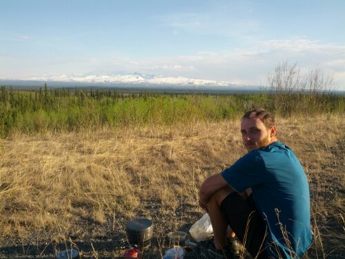
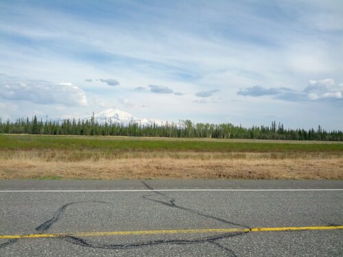
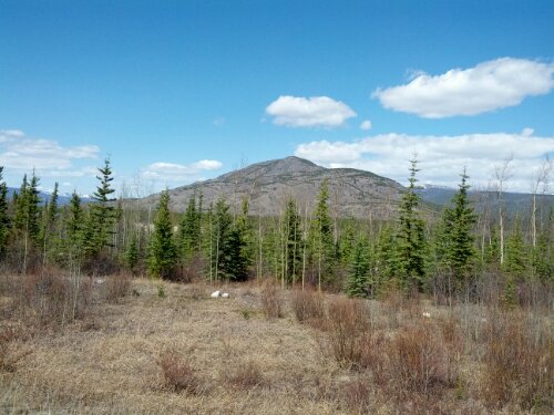
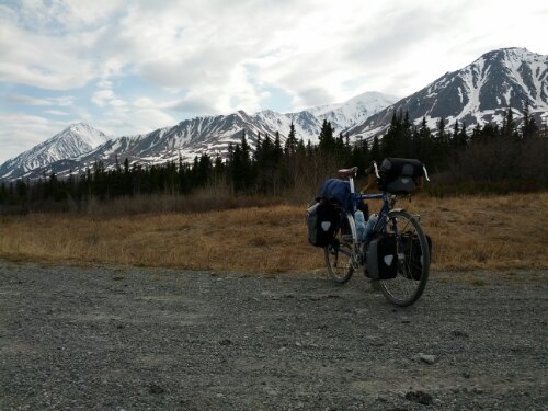
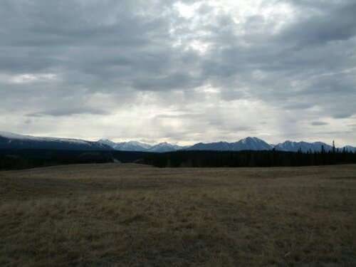
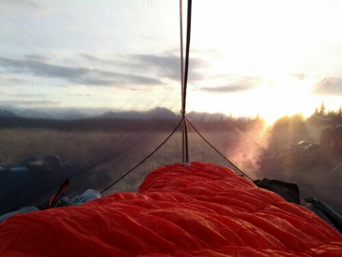
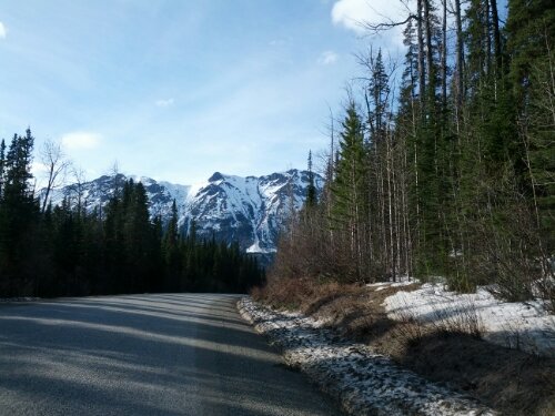
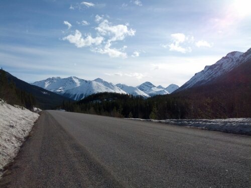
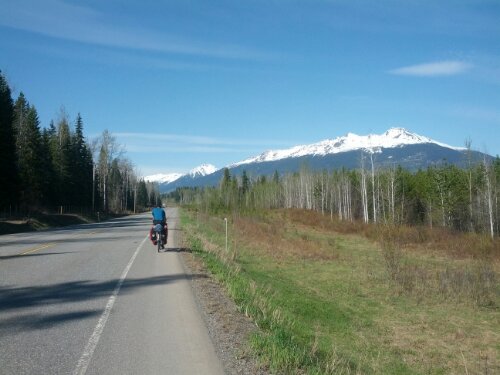
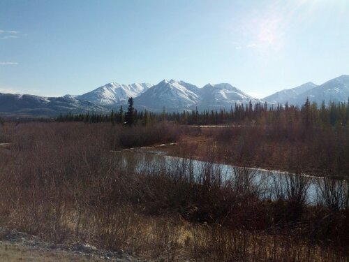
As the sun dips lower, we exit this mountain range and are greeted with an amazing view of huge mountains in the Wrangell-Elias range to the south. Donald spots a grizzly bear and it scampers away loudly into the woods. It’s harder to find a camp site here since much of the land adjacent to the road is privately owned and has no trespassing signs. Eventually a decent stretch free of signs appears and we push our bikes through a field of tall grass to make camp for the night.

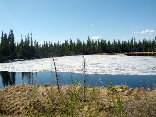
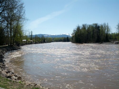
In the morning a caribou walks past our camp site obliviously as we begin to pack up. It’s another hot day – upper seventies – the news is calling this the great Alaskan heat wave. The road turns flat and there is severe flooding along parts of the road, probably due to increased snow melt from the heat.

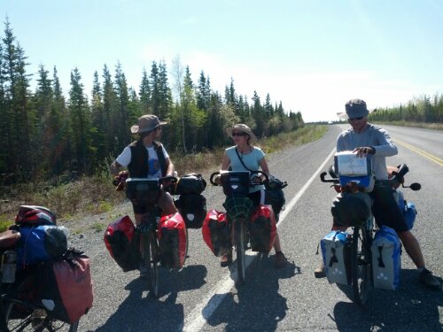
We come across a group of bicycle tourists headed east – two couples. They have just started from Anchorage and are headed south, potentially to Argentina. But first they’ll be stopping by in Seattle to give a talk about their previous tours. I hope I can meet up with them again there.

Besides meeting other tourists, these past days have been the most uneventful in a while. Perhaps the tour has become routine, perhaps I’m simply ready for it to end, or perhaps they really were just boring. From here it’s a two day ride to Palmer, AK which is where my path diverges from Donald’s. There’s enough time for one more rest day and then I’ll make the eighty mile trip up to Talkeetna to start the next part of my trip.

Mileage:
Day 35: 67
Day 36: 51
Day 37: 0
Day 38: 75
Day 39: 66
Total: 2195 miles
image
image
image
image
image

Days 31 – 34: Whitehorse, YT – Beaver Creek, YT

It was nice to spend some rest time in Whitehorse after so long away from civilization. We toured the Yukon Brewing Company’s brewery, ate some much needed ethnic food, and restocked on food and supplies. But it was time to get back on the road.

Just like in Prince George, we enter town in freezing weather and exit in warm weather. It’s in the seventies as we climb the hill out of Whitehorse and the terrain soon changes to rolling plains as we head northwest. The day is long but largely unremarkable and we stop to make camp in the forest off the side of the road at nearly nine. Our camp site is right near the top of a bluff and we have spectacular views while eating dinner.

Another day back on the road and larger mountains begin appearing as we approach the town of Haines Junction. Stopping in town for lunch we refill our water bottles before getting back in the saddle. There’s a very large hill out of town and we have to take a few breaks since Donald isn’t feeling too well. I stalk a pheasant through the woods near a stream before meeting a swarm of mosquitoes and running away.

We finally reach the top of the hill and enter a valley. Snow-capped mountains line our left as far as the eye can see with smaller mountains dotting the landscape to the right. It’s already getting late and we find a campsite. I think I’ve now found the pattern for my favorite type of next-to-the-road campsite. It’s where there’s a steep upwards embankment on the side of the road with a flat plateau on top. From the top of this kind of spot you often find excellent views and yet are completely invisible from the road.

Tonight we find such a spot; it’s a grassy field with amazing views of mountains to the north and west. I eschew my rain fly and wake up periodically through the “night” to admire the surroundings through my tent’s mesh walls. The nearly full moon is setting over the mountains but it is too cold and I am too tired to get a photo.

It gets pretty freezing overnight but warms up quickly around ten. I don’t really understand this since the sun has been up since three. Go figure. We come upon a large lake (frozen of course) and the road winds around it for miles. Then something we’ve been waiting thirty three days for finally happens – we run into another touring cyclist. Fernando started in Anchorage two weeks prior and is heading south. He had some bike troubles – cracks on his rim but seemed in good spirits. I hope he makes it to Whitehorse to get his bike looked at.

Just a few miles later we run into another touring cyclist, Tomas from Argentina is heading from Fairbanks to Florida. Looks like touring season has officially started up here.

A quick lunch in the town of Destruction Bay and we’re back on the road. The next hour is probably the fastest we’ve ever done, averaging over 18mph with only a sporadic tailwind. We continue on for a couple more hours before calling it a day.

Just as touring season is starting, so is mosquito season – liberal application of DEET is becoming the top priority upon reaching camp. Today’s site is less scenic and we spend half an hour looking for a good tree for our food, eventually settling on one where the branch does not reach far enough from the tree.

Luckily our food is still present in the morning and we hit the road with our eyes set on the town of Beaver Creek for a much needed shower. A couple in a RV pulls up along side us and offers us soda. A quick chat later and we’re back on the road. We run into two touring cyclists heading south, first to Montana then Indiana.

For the third time in two days we run into touring cyclists heading south and for the third time we hear about a couple ahead of us. For the first month of our trip we heard from a few sources that there was a solo Japanese tourist about a week ahead of us and we were the only other ones that had come through so far. But now there’s this new couple. With each southbound traveler we meet, we find out more about them. They’re two and a half hours ahead of us, or four hours, or 30 miles. They’re coming from Seattle too. They’re averaging 65 miles a day. It seems likely they passed us during our two rest days in Whitehorse; I hope we can catch up and meet them.

We press on, running low on water. The road curves north and the mountains that have been with us for three days start growing more distant before disappearing entirely. There are rolling hills but the lack of mountains on either side causes an uneasy sensation – no longer are there any landmarks ahead to watch approach. The trees are more stunted now as we cross into the permafrost and it seems as if the land’s end is approaching.

In truth it is only an invisible line growing near. We reach the town of Beaver Creek for our last night in Canada. The border is only twenty miles away now and tomorrow night we’ll be back in the US.

Nine days until Talkeetna.

Mileage:
Day 31: 82
Day 32: 50
Day 33: 72
Day 34: 80
Total: 1936 miles

image
image
image
image
image

Days 22 – 30: Iskut, BC – Whitehorse, YT

The road from Bell II to the town of Dease Lake is 150 miles long and we had decided to make it in two days. When I last left off we had covered the first 96 miles in a day, stopping in Iskut. As such our next day was to be a bit on the short side, covering the remaining 54 miles.

We were lucky to split it up this way; the road from Iskut to Dease Lake is hilly. A few several hundred feet climbs greet us on our way out of town and we come upon a long downhill into a valley. The best kind of downhill is one where you can take full advantage of the hill to either rest or increase your pace. This hill provided neither opportunity. Winding through steep switchbacks and gravel we lose over a thousand feet of hard-earned elevation, riding the brakes the whole way. Across a river, the road turns back upwards into a never-ending climb. Stopping for a quick lunch it begins to snow and we get back on the road.

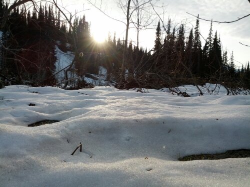
As the road keeps on going up, more and more snow appears on the sides of the road and numerous streams wind their way through the snow and pine forests. The snow increases in intensity as we reach an alpine meadow at the top of the pass and a lone swan glides across the surface of a small lake. Eventually we reach the pass and are rewarded with a long downhill into the town of Dease Lake, crossing the continental divide into the Arctic.
Dease Lake is the last town for a long while so we stock up on groceries. This mainly means candy. Heading north out of town we are peppered with rain showers but luckily none of them last too long. As soon as the terrain begins to get boring we run into more spectacular mountains. Crossing each new mountain pass gives a new view of more unfathomable stretches of forest. The forest seems to be endless and I have to remind myself that it is not, for it is precisely its end that I pursue. Near the top of another pass we call it a day, making camp in a snow plow pullout, surrounded by feet of snow.

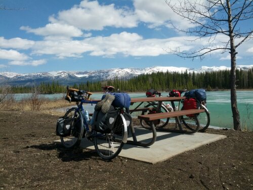
Back on the road in the morning, there are two small towns ahead but neither of them have anywhere to eat so we press on. Boya Lake provincial park sits a few kilometres off the road and we make the detour in hopes of finding potable water. The water is still turned off for the winter but we are greeted with fantastic views of mountains over a frozen turquoise lake. The park is well maintained and has dozens of campsites, all empty because summer had not yet arrived. It’s a bit eery.

Heading north once more, we are reaching the end of the Cassiar highway. The mountains give way to rolling hills and miles of forest along the road has burned down. The less-spectacular scenery appears to have affected the road construction crew as well – they seem to have thrown in the towel. The road up here is hardly graded – flat sections of road are punctuated with extremely steep hills and between the worsened road conditions and unspectacular view the ride begins to become a bit of a chore.

There’s an acceptable spot on the side of the road and we make camp for the night. A thumping noise persists throughout the night – it sounds a bit like a motorcycle engine starting or a large heavy ball bouncing on dirt. Very strange. In the morning while getting our food down from a tree we find the source of the noise – a pheasant flapping its wings in a bizarre (assumed) mating ritual.

At this point that I should probably mention that it is difficult to keep my phone charged when spending many days between towns. As such I don’t have many photos for the blog, but there are plenty to show when I return from my trip and am able to get the photos off of my camera.

Another day brings us to the end of highway 37, the Cassiar highway. The border into the Yukon is four kilometers before the end of the road and we stop for photos and to use the restroom. While admiring the signs for the upcoming new province, a grizzly bear appears off the left side of the road and scampers away.

We pull onto the Alaska highway and stop for lunch in Nugget City. Once again the definition of city is being used rather liberally – there is nothing here but a combination gas station/lodge/restaurant. The first forty or so miles on the Alaska highway are bland; rolling hills through pine forest that move by at a glacial pace thanks to a heavy headwind, but mountains eventually return and we make camp in a section of not-too-dense forest off the road.

Another day, more mountains. We cross the continental divide again, back into the pacific and a wild cyclist appears on the road in the middle of nowhere. He’s an older gentleman on a road trip with his wife and every afternoon he takes a bike ride. We speak for a bit and ride on into the rain.
The days are blurring together once more. We camp on the side of the road again and yesterday’s rain turns into today’s snow. Three rabbits run in circles around a bush off the road and a caribou trots across the highway while we at taking a break. The snow relents for just enough time for us to make camp and dinner before returning even stronger. It piles up on our tents overnight and the temperature continues to drop.

Finally it’s just one more day until Whitehorse, the largest city in Yukon. It’s been six days since my last shower and twelve since I last did laundry so I’m ready to make it to a city for a rest day. The temperature is even colder and I add a hat and buff to my already long list of worn clothing. Unfortunately Donald is rather tired in this last stretch and the day turns into a long slog, arriving in Whitehorse at ten at night. Luckily it practically never gets dark now and there’s plenty of sunlight left even at such a late hour.

We’ll be taking two rest days here in Whitehorse before starting the leg to Alaska.

Mileage:
Day 22: 54
Day 23: 67
Day 24: 69
Day 25: 69
Day 26: 70
Day 27: 68
Day 28: 69
Day 29: 0
Day 30: 0
Total: 1652 miles

image
image
image
image

Days 17 – 21: New Hazelton, BC – Iskut, BC

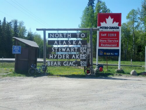
It was another warm and beautiful day leaving New Hazelton. The trees lining the highway (aspen?) are a vibrant green and snow-capped mountains dot the horizon. We make quick work of our final miles on highway 16 and soon reach the junction with 37, the Cassiar Highway, marked by a large quantity of slightly redundant road signs. We pull over for a photo op and have lunch at the lone gas station at the junction.

The town of Kitwanga sits at the base of the highway and I stop to pick up some bear spray from the general store in town. We’ve been hearing horror stories of bears for the last few days and I want something to put my mind a bit at ease. Heading north into the wilderness and wind, the scenery does nothing but become more impressive. Mountains continue to line both sides of the road as it snakes through the valley, moving from ponds and reeds to dense pine forest and back again.

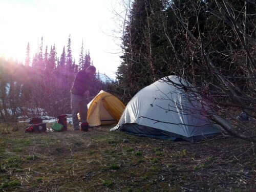
As evening approaches we begin searching for a campsite for the night and soon find a pulloff on the side of the road that goes back far enough to offer some privacy from the highway. After setting camp and cooking some freeze-dried meals we put our food up in a tree for the night. I have a bit of trouble trying to apply my mountaineering knots to the situation but manage to keep the food aloft somehow.

Though the sun has a couple hours left, the mosquitoes begin coming out in force and we retire to our tents. Reading my book, I count nine of the blood suckers on just one of my tent walls. Sleep comes and goes as I am awakened by rustling in the forest. A bear is trying to get our food, and its attempts go on for hours. Luckily we find in the morning that our food is still hanging from the tree.

There is no civilization here. Rest stops with pit toilets and trash cans (called “litter barrels” here) are spaced about fifty miles apart, and the towns are much more infrequent. We fetch water from a stream in the morning and get on the road late. It’s hot again and we climb over hills, winding our way north. Soon larger mountains than we’ve been seeing appear on the horizon and the constant up and down turns into just up as evening approaches and we reach Meziadin Junction. The road here splits and heads off towards Stewart. One part of Alaska is only thirty miles away now but we have nearly a thousand miles to go before we reach our border crossing.

At the junction there are two separate pairs of hitch hikers trying to make their way north, and a black bear and her cubs is a hundred yards up the hill, right next to the road we need to take. We talk to the hitch hikers a bit while waiting out the bears and eventually head into the hills, bear spray in hand. Over the next three miles we run into two more black bears right on the side of the road, but waiting at a distance for passing cars to scare them off seems to be a good strategy. One truck driver is especially helpful, stopping his truck and repeatedly honking to scare off the bear.

The hill keeps on rising and the sun dips briefly below the steep side of the mountain, causing the temperature to plummet. My legs feel fresh but Donald is flagging [ed. note: because he didn’t eat enough food] so we begin to hunt for a campsite. There’s another pullout a couple miles later; it doesn’t have much privacy from the road but we need to stop so we take it. Treeing the food is much easier this evening after I’ve had some time to think of the proper way to do it. Perhaps the nearby river simply muffles the sound, but I don’t hear any bears trying to get at our food here.
Rain and cold greets us the next morning. While fetching water the rain nearly stops, teasing us with the prospect of a decent day before returning to a downpour. After a bit of sitting in our tents in dread we set off once again into the hills, climbing higher through the miserable weather.

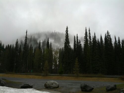
There are feet of snow in the forests and meadows on either side of the road now and a mist comes and goes. On my left pine trees dot a snowy lake, a light mist covering it all. I want to take a photo but between my reluctance to bring out my camera in the rain and the fact that my clumsy heavy gloves make operating it time consuming I settle for burning the memory into my head. A flock of small birds sits in trees on the side of the road, flying further down the road with us as if leading the way.
These scenes are able to remove me from the cold briefly but soon reality returns. I am now experiencing the freeze-thaw cycles of the seasons every twenty minutes – as we race down hills large drops of rain pelt me as my legs and face freeze, only to once again feel warmth while climbing steadily up a steep hill.

This continues on for a couple hours before a long descent brings us out of the mountains. The mist has lifted and snowy mountains are visible very close on either side as we follow a river towards the town of Bell II. Eventually we arrive to find the town consists of a lodge and only a lodge. The rates are exorbitant but the shower and bed are worth it.
The next day is rainy and cold and we decide to take a rest day in Bell II.
Back on the road Monday and we have to be out by ten, super early for us. The bridge in Bell II was damaged by a truck last summer and they are repairing it now. As such the bridge is closed for much of the day and we have to make a certain time window or be stuck waiting.

We cross the bridge in front of the cars and soon it begins to rain. Climbing over multiple small mountain passes, the rain eventually relents. There are more snow covered mountains all around us, the peaks shrouded by clouds. We pass a black bear that just stares at us and get warned of an upcoming grizzly but never see it. The bear spray makes its way into my handlebar bag.

Eventually some blue sky shows itself and a tailwind picks up. Cars are far and few between as they cannot pass the bridge at Bell II and the highway becomes a bike path. Over another pass, the road comes upon a wide valley. The mountains are getting smaller now, or less snowy at least and we begin making good time. Another few hours in the saddle lands us in the outskirts of Iskut.

Mileage:
Day 17: 67
Day 18: 64
Day 19: 52
Day 20: 0
Day 21: 96
Total:  1186

Halfway there!

image
image
image
image
image

Days 12-16: Prince George, BC to New Hazleton, BC

The weather has warmed up significantly. On the road into Prince George I was wearing my warmest gloves to keep from freezing but it was a balmy seventy degrees exiting town. The first twenty miles went by quickly but a headwind picked up and slowed our progress towards the town of Vanderhoof.

Towns are more prevalent out here than I initially thought and so we’re going to be hopping from town to town for the next few days.
Sunday brought more subdued headwinds and progress was better as we continued west, stopping in the town of Burns Lake. The Chinese restaurant in town is closed Sundays but the pub has a surprisingly good menu.

Another day on the road brings strong headwinds once more. A downed power line stops all traffic on the highway for over an hour and we decide to call it a night in the town of Houston. The Chinese restaurant here is closed on Mondays and we head to the pub in town instead. The menu is not as good as yesterday’s.

Heading out from Houston the scenery is getting nicer. The rolling plains and pine trees are yielding to snow-capped mountains. We have a large climb and more magnificent views as the mountains grow closer. The town of Smithers has the last bike shop for a long while so I pick up some more tubes. Smithers has a pretty nice downtown area and we stop for a late lunch and decide to stick around for the night. Three beers later and we head out in search of a motel. Not a block later we get stopped by two girls handing out cookies. It turns out one of them, Lillian, had done a tour in the past. She offered us a place to stay for the night and we took her up on the offer. Twelve miles out of town and a big hill later we arrive at the farm at which she’s staying.

A good night’s sleep and an excellent breakfast later we backtrack the twelve miles to Smithers and continue west. Stopping in a tiny town for lunch, the only cafe in town is no longer a cafe. It’s an office of some sort but they just haven’t bothered to take down the sign or even erase the menu on the chalkboard. This is a bit of a recurring theme up here – places will often have a large “open” sign out front only to be shuttered permanently. And the restaurants and motels that are in fact open more often than not have a “for sale” sign prominently displayed. It’s all rather strange.

The scenery continues to be amazing and before long we reach the town of New Hazelton. We head off tomorrow into bear country and onto the Stewart-Cassiar highway, which will eventually link us up with the Alaska highway. There are very few towns for the next several hundred miles so I’ll be checking in when I can.

Mileage:
Day 12: 64
Day 13: 80
Day 14: 52
Day 15: 54
Day 16: 54
Total: 907

image
image
image
image
image